
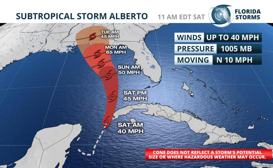
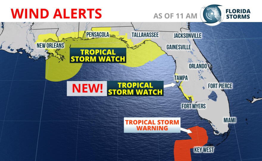
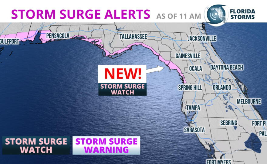
Subtropical Storm Alberto is now forecast to strengthen and take a track a little closer to Florida's west coast. This has prompted the National Hurricane Center to issue a Tropical Storm Watch for much of the Greater Tampa Bay Area. A Storm Surge Watch has also been issued for sections of the Nature Coast north of Crystal River.
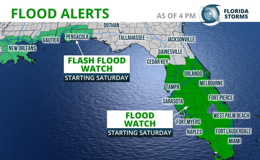
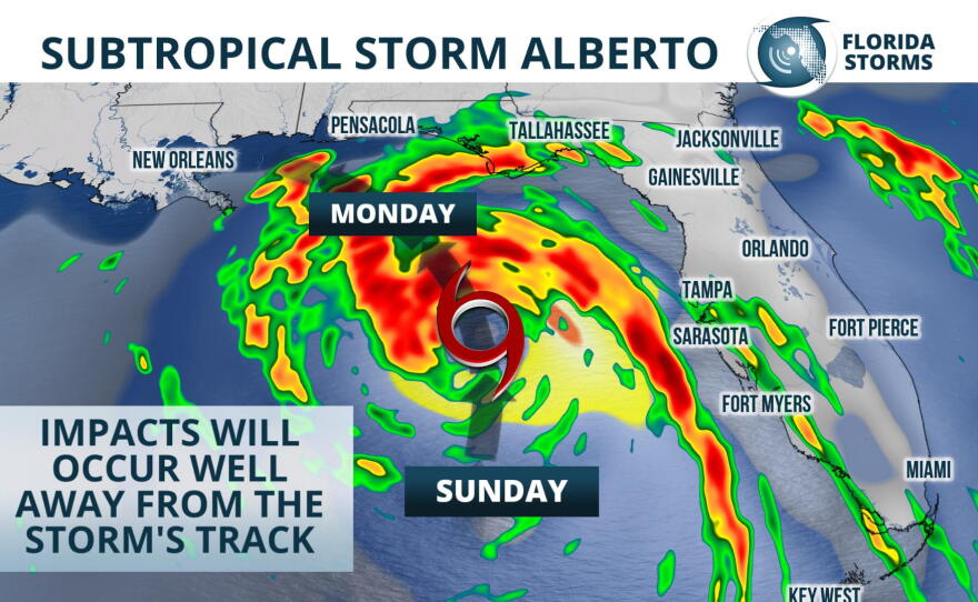
Rain from the season's first named storm moved into much of South Florida early Saturday morning, but in most cases it has been light and steady. Heavier rain bands from Subtropical Storm Alberto are forecast to move across the peninsula Saturday night and Sunday, and a Flood Watch continues for all of central and south Florida through Sunday evening.
Beyond Sunday, Subtropical Storm Alberto is forecast to turn to the northwest - further away from Florida's west coast - and approach the Florida Panhandle. By Monday, conditions are projected to become more favorable for strengthening into a formidable tropical storm, and Alberto is likely to make landfall near or just west of Pensacola. Lingering moisture will likely lead to several more days of enhanced rainfall across the peninsula, but the coastal hazards should subside some Monday and Tuesday.
In Central Florida, the heaviest rain is likely to move in by Sunday morning and continue through Monday. Tropical-storm-force winds are expected beginning early Sunday morning and persisting throughout the day. Afternoon and evening thunderstorms are also possible through Thursday. Projected rainfall in most places is between 2 and 4 inches, which could lead to localized flooding. Locally higher rainfall amounts are expected in areas that receive multiple rounds of thunderstorms.
There is also an isolated tornado risk Sunday and Monday should stronger thunderstorms develop. This risk may also continue through early next week, depending on how long it takes the remnants of Alberto to drift away.
Subtropical Storm Alberto's moisture and resulting downpours may linger over the state through much of next week, further aggravating the flooding risk. However, other tropical weather hazards such as surge, wind and coastal flooding along the Gulf coast should subside by Tuesday.