
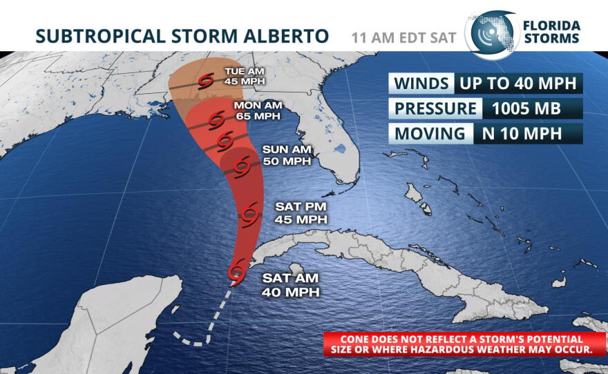
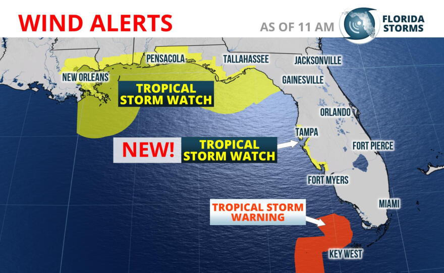
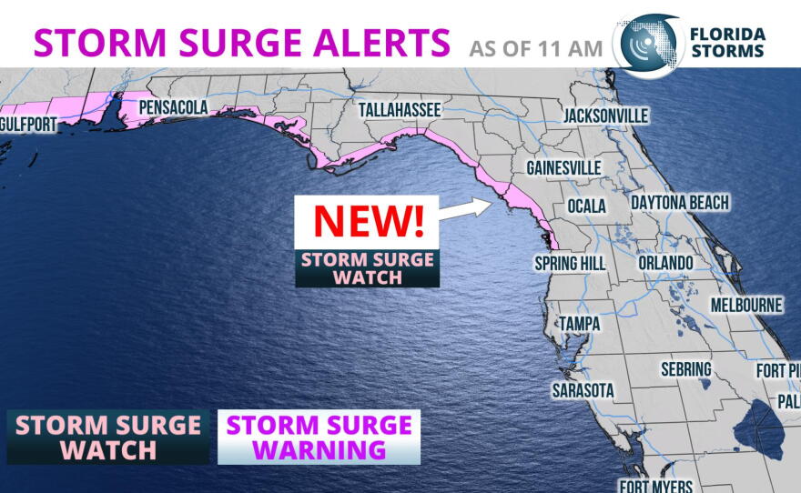
Subtropical Storm Alberto is now forecast to strengthen and take a track a little closer to Florida's west coast. This has prompted the National Hurricane Center to issue a A Tropical Storm Watch for coastal regions of Bay and Gulf counties. A Storm Surge Watch is in effect for the entire Florida panhandle coastline, extending as far east as Dixie County.
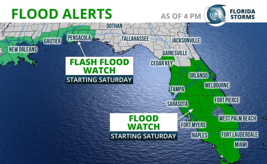
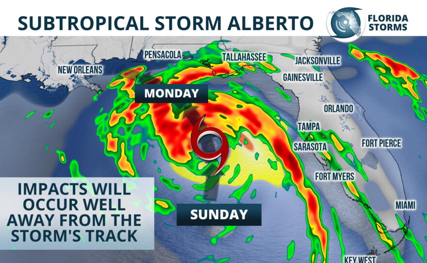
Rain from the season's first named storm moved into much of South Florida early Saturday morning, but in most cases it has been light and steady. Heavier rain bands from Subtropical Storm Alberto are forecast to move across the peninsula Saturday night and Sunday, and a Flood Watch continues for all of central and south Florida through Sunday evening.
The coastal hazards associated with Alberto, namely high surf, coastal flooding, and minor surge will begin to affect portions of southwest Florida Saturday night, moving up the coast to west-central sections of the state on Sunday. Water spouts and an isolated tornado are also possible in the stronger rain squalls Sunday, as low-level spin increases on Alberto's eastern side.
Beyond Sunday, Subtropical Storm Alberto is forecast to turn to the northwest - further away from Florida's west coast - and approach the Florida Panhandle. By Monday, conditions are projected to become more favorable for strengthening into a formidable tropical storm, and Alberto is likely to make landfall near or just west of Pensacola. Lingering moisture will likely lead to several more days of enhanced rainfall across the peninsula, but the coastal hazards should subside some Monday and Tuesday.
The heaviest rain is likely to arrive to the Big Bend-Tallahassee area Sunday night and continue through Monday. Thunderstorms with heavy rain are possible through Wednesday. The strongest cells could produce damaging wind or an isolated tornado. Most places will see between 3 and 5 inches of rain, which could lead to localized flooding.
Coastal flooding and storm surge flooding is also possible, but highly dependent on the track and strength of the storm. The National Weather Service has advised that 2 to 4 feet of storm surge inundation may occur in the storm surge prone areas.
Subtropical Storm Alberto's moisture and resulting downpours may linger over the state through much of next week, further aggravating the flooding risk. However, other tropical weather hazards such as surge, wind and coastal flooding should subside by Tuesday.