
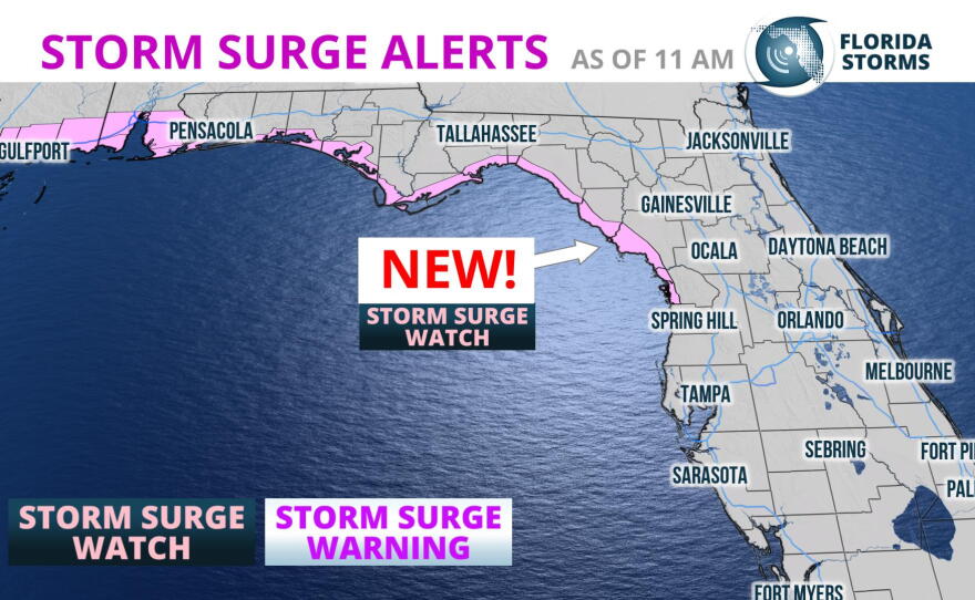

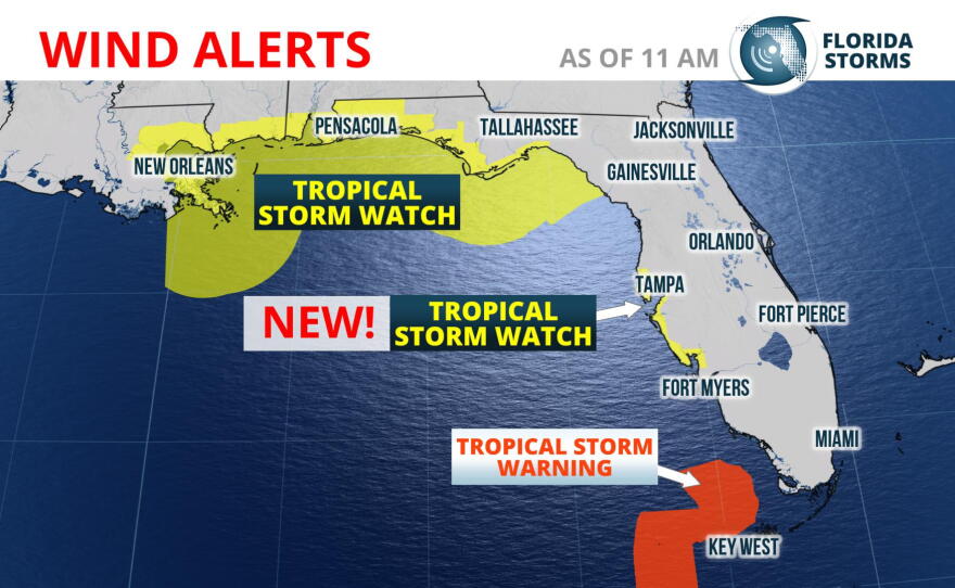
Subtropical Storm Alberto is now forecast to strengthen and take a track a little closer to Florida's west coast. This has prompted the National Hurricane Center to issue a Tropical Storm Watch for much of the Greater Tampa Bay Area. A Storm Surge Watch has also been issued for sections of the Nature Coast north of Crystal River.
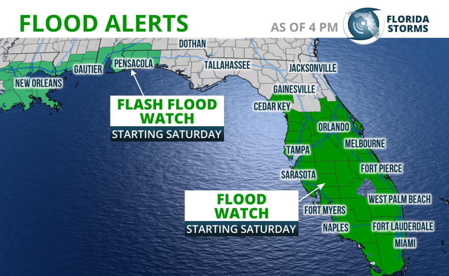
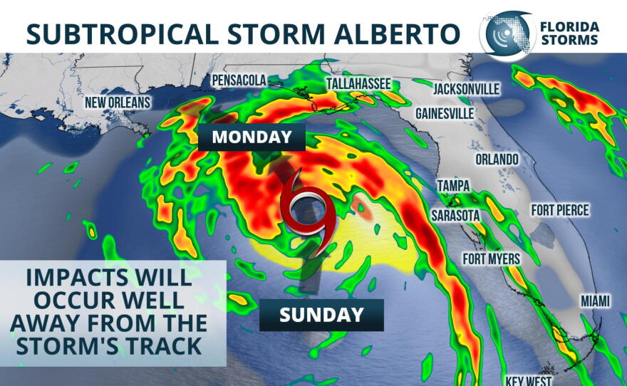
Rain from the season's first named storm moved into much of South Florida early Saturday morning, but in most cases it has been light and steady. Heavier rain bands from Subtropical Storm Alberto are forecast to move across the peninsula Saturday night and Sunday, and a Flood Watch continues for all of central and south Florida through Sunday evening.
The coastal hazards associated with Alberto, namely high surf, coastal flooding, and minor surge will begin to affect portions of southwest Florida Saturday night, moving up the coast to west-central sections of the state on Sunday. Water spouts and an isolated tornado are also possible in the stronger rain squalls Sunday, as low-level spin increases on Alberto's eastern side.

The heaviest rain is likely to move into Sarasota and Bradenton by by Sunday morning, spreading across the Tampa metro by midday Sunday. Periods of heavy rain are then likely to continue through Monday afternoon. Early rainfall projections through Tuesday are between 4 and 6 inches, with locally higher amounts up to 8 inches possible. This could lead to localized urban flooding in low-lying areas. River flooding is also possible in the days following the event.
Wind gusts between 40 and 50 mph are possible immediately along the coast, beginning early Sunday morning and lasting off and on for much of the day. Minor storm surge is expected along the gulf barrier islands stretching from Clearwater to Sarasota. Breezy conditions and waterspouts are possible along the coast, with a few isolated tornadoes possible across interior sections where locally strong thunderstorms develop.
Beyond Sunday, Subtropical Storm Alberto is forecast to turn to the northwest - further away from Florida's west coast - and approach the Florida Panhandle. By Monday, conditions are projected to become more favorable for strengthening into a formidable tropical storm, and Alberto is likely to make landfall near or just west of Pensacola. Lingering moisture will likely lead to several more days of enhanced rainfall across the peninsula, but the coastal hazards should subside some Monday and Tuesday.
The Florida Public Radio Emergency Network will provide frequent updates on this developing weather story all holiday weekend, both on the Florida Storms social media accounts and in the app Florida Storms.