

Here’s a corrected version with grammar, spelling, and obvious transcription errors fixed while keeping your original meaning and weather-reporting style:
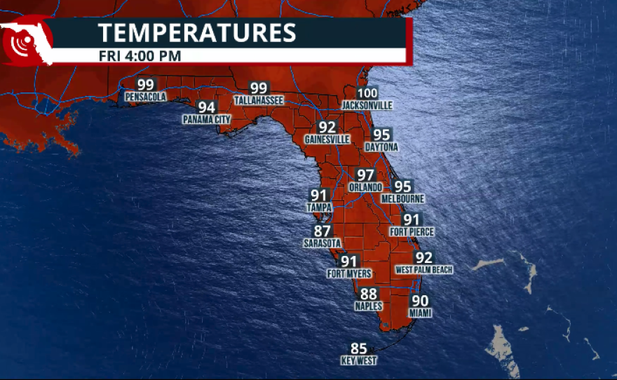
Record heat across the entire peninsula continues. Specifically, Miami International Airport reached a historic temperature: 100°F.
Although South Floridians might think that we have hit 100°F many times in the past, only a few have actually experienced an air temperature of 100°F—specifically at MIA, where the official station is located. The temperature has hit 100°F only one other time, and that was in 1942. So, since records began in 1895, the temperature has risen to 100°F only twice.
Well, folks.. We did it!
— Ryan Phillips - NBC6 (@RyanNBC6) August 18, 2026
100° at Miami Intl Airport today at 2:47 pm.
Last time we recorded 100° was July of 1942. @nbc6 pic.twitter.com/Nchx1k018w
Why so hot?
All the ingredients are there for record heat across South Florida and the rest of the peninsula. A high-pressure system over the Gulf of Mexico is bringing an offshore wind along Florida's central and east coasts. Although temperatures have remained hot along the west coast of the peninsula, they’re not as hot as across the eastern half. This is because the wind warms even more as it travels over the hot land.

Saharan dust has also been present across South Florida, which has really put a lid on thunderstorm activity across the region. In addition, the west winds have prevented the sea breeze from forming and moving inland as it usually does during the summer months.
8/17 @ 5PM: It's been another hot & dry day across South Florida with above average heat and ample sunshine. The lack of rainfall, any significant cloud cover, and hazy skies across our area is due to a large plume of Saharan Dust that remains in place over South Florida. (1/2) pic.twitter.com/eHUHbpLcVH
— NWS Miami (@NWSMiami) August 17, 2026
Remember, thunderstorm activity and isolated showers bring temperatures down during summer afternoons. But without the sea breeze helping to develop thunderstorms, the day remains full of sunshine, and temperatures remain hot.
Will there be any relief?
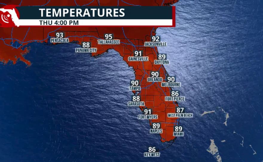
Wednesday is forecast to be another hot day across South Florida. Records could be broken again, but temperatures are not expected to reach triple digits at official stations. However, unofficial stations across South Florida could come very close. Fort Lauderdale's high on Wednesday is forecast to reach 95°F, and it could break a record at Fort Lauderdale-Hollywood International Airport.
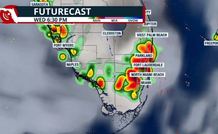
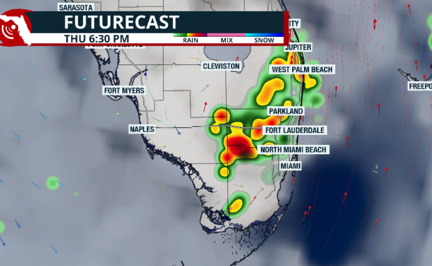
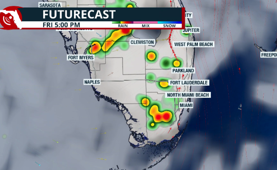
In Miami, the temperature could once again hit a record. This time, if it reaches 96°F, it would break the old record. A few thunderstorms could develop late Wednesday afternoon, but storm chances will be higher earlier Thursday and Friday. This will keep temperatures closer to 94°F.
Nights will also remain very warm. Tuesday night into Wednesday morning, temperatures will barely dip below 82°F and remain in the low 80s through the rest of the week.
Saharan dust will also slowly diminish across the region, and skies will remain partly to mostly clear during the evenings.
For now, the weekend looks to return to a more typical summertime pattern, with winds shifting more out of the south. This should allow sea breezes to develop Saturday and Sunday afternoon.

According to Climate Central's tool, developed from Climate Central's peer-reviewed research, the Climate Shift Index is 5, meaning climate change made the daily average temperature on August 18 at least 5 times more likely.
